
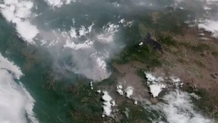
US National Oceanic and Atmospheric Administration (NOAA) geostationary satellites captured the impact of California’s largest wildfire so far this year.
According to information from FoxNews, Since it began on July 29 in the Klamath National Forest in Siskiyou County, California, the McKinney Fire has devastated more than 20,000 hectares, prompting more than 2,000 residents to be evacuated. .
In addition, on August 1, through a statement, the Siskiyou County Sheriff’s Office reported two fatalities, who perished inside a car:
The vehicle was located on a residential road along Doggett Creek Road, located just off Highway 96, west of the Klamath River.
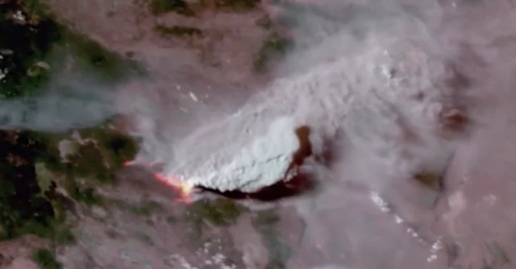
GOES 17 satellite images released via the agency’s official Twitter account show the extent of the fire as it continues to spread:
NOAA’s GOES 17 satellite observed how the McKinney Fire in California showed explosive growth on July 30. The wildfire has become the largest fire in California in 2022, burning more than 50,000 acres as thousands of residents are forced to evacuate.
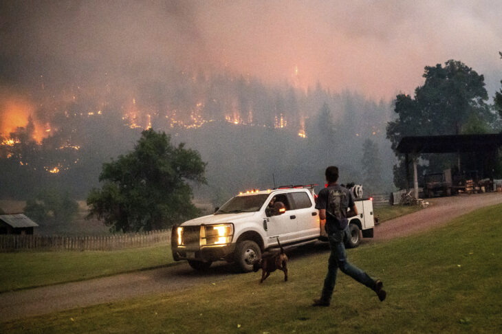
At the moment, much of the Pacific Northwest remains under red flag warnings from the National Weather Service. The fire remains at zero percent containment as the fire has been aggravated by days of scorching temperatures and extreme drought conditions, which contribute to the spread of the fires, complicating efforts to douse the flames.
Source: Okchicas
With 6 years of experience, I bring to the table captivating and informative writing in the world news category. My expertise covers a range of industries, including tourism, technology, forex and stocks. From brief social media posts to in-depth articles, I am dedicated to creating compelling content for various platforms.


