
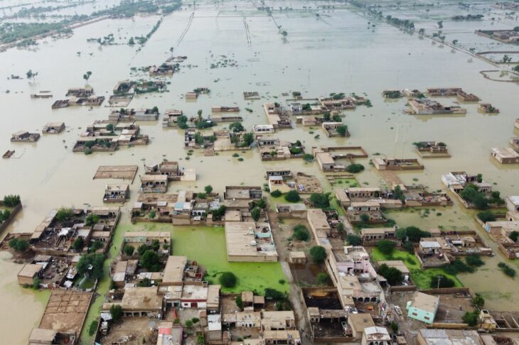
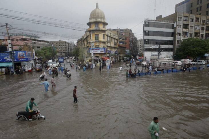
Since last June, unprecedented flooding in Pakistan caused by record monsoon rains has washed away roads, crops, infrastructure and bridges, leaving at least 1,136 dead and 33 million affected.
The scope and severity of the flooding in the Asian country, stemming from two months of unusually heavy monsoon rains, are drawing comparisons to the devastating rains of 2010. However, in some respects, it may exceed that benchmark.
Pakistani officials attribute these extreme events to climate change. In addition, they assure that the country is suffering the consequences of irresponsible environmental practices in other parts of the world.
Tens of thousands of families have left their homes for safer places, moved in with relatives or in state-run camps, while others have spent the night out in the open, waiting for food, assistance, including tents, food and medicines.
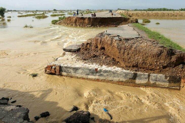
According to the Pakistan National Disaster Management Authority (NDMA), more than 80,000 hectares of farmland, more than 3,400 kilometers of roads and 149 bridges have been devastated by the water.
This August 30, during a press conference, the Prime Minister of Pakistan, Shehbaz Sharif, described the floods as “the worst in the history of the country”. In addition, he stated that the economic losses from the floods could reach at least ten billion dollars, necessary to repair infrastructure and provide humanitarian aid.
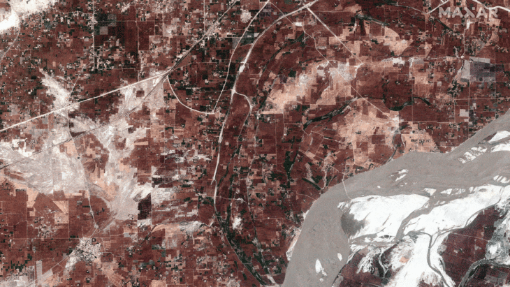
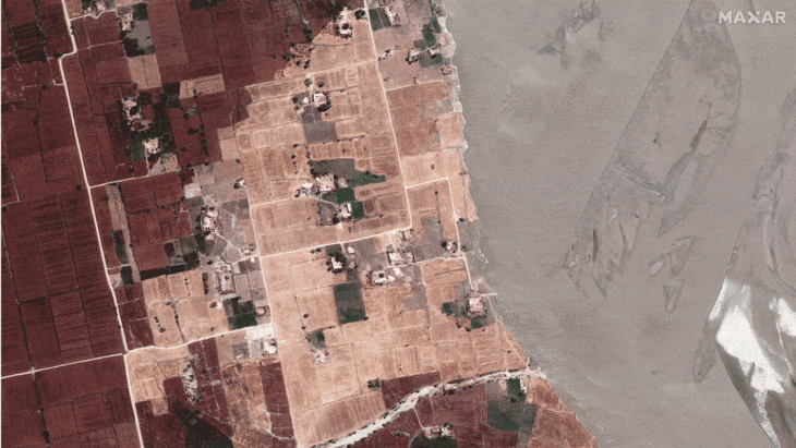
Satellite images released by Maxar Technologies have revealed the full extent of Pakistan’s deadly floods. The shots show an overview of houses, villages and fields near the town of Rojhan in Rajanpur district, captured on March 24 this year, compared to those on August 28.
General view of the Indus river before and after the flood in Rajanpur, Pakistan
Close up view of houses and fields before and during the floods in Rajanpur, Pakistan
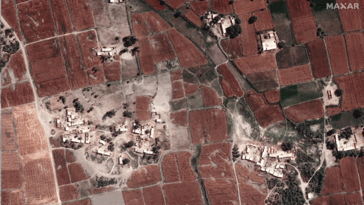
Fields and houses along the Indus River before the floods in Rojhan, Pakistan
Source: Okchicas
With 6 years of experience, I bring to the table captivating and informative writing in the world news category. My expertise covers a range of industries, including tourism, technology, forex and stocks. From brief social media posts to in-depth articles, I am dedicated to creating compelling content for various platforms.

")


